1199 Hilt Road | Wrightsville Borough | York County
OUTSIDE OF LANCASTER COUNTY
Both of these areas are located across the Susquehanna River in Wrightsville. Highpoint Scenic Vista offers one of the best views of the Susquehanna and the surrounding farmland. To the south you are able to see the Turkey Hill Windmills and to the north you get a fantastic view of Columbia and the Wrightsville bridge.
Wilton Meadows is only accessible by hiking in. You do this by taking the Mason Dixon Trail from Highpoint Scenic Vista or from Riverfront Park. I recommend hiking from Highpoint because the trail from Riverfront Park takes you along a busy road, and that's not my idea of good hike. Once in the preserve there are lots of young trees and meadows full of wildflowers.

Since Wilton Meadows can only be reached by hiking, it tends to get less traffic. Because of this the wildlife is abundant. Every time that I've been here I've seen several deer. I've also seen snakes, a racoon and lots of pollinators and birds.
Distance: 5 plus miles of trials
Terrain: dirt | rocks | water | wooded | grass
Difficulty: medium to well
Activities: hiking | trail running | leashed dogs
Parking: mid size parking lot
Restrooms: port-o-potty at Highpoint Scenic Vista
Website: lancasterconservancy.org ychsd.org
Highpoint Scenic Vista | Heritage Trail | .5 miles
Medium Rare | 10- 20 min
This paved trail wraps around the hill as it takes you to the scenic vista.
Highpoint Scenic Vista | Lower Meadow Trail | .5 miles
Medium Rare | 10-20 min
This trial loops around the meadow, connecting with the heritage trail at 2 different points. There are 2 viewing areas along this trail.
Highpoint Scenic Vista | East Meadow Trail | .4 miles
Medium Rare | 10-20 min This trail begins at the scenic vista and loops around the meadow connecting with the Lower Meadow Trail.
Mason Dixon Trail | 2.5 miles | blue marker
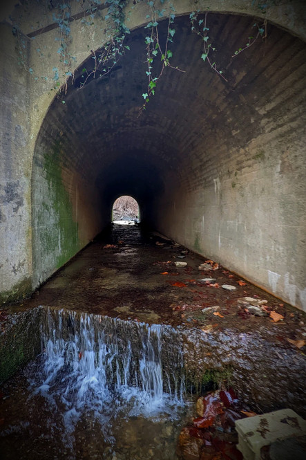
Medium Well | 50 min-1 hr 40 min This portion of the Mason Dixon Trails starts in the south west corner of Highpoint Recreation Park, goes up to the Scenic Vista and then through a meadow into the woods. You then cross Rt 462 and go through the gate of The Ranch. This is private property, but you are able to follow the paved road for several hundred feet before the trail goes down a set of steps to the right. The trail winds through the woods for a bit and you will then come to a culvert that goes under Rt. 462. The water is shallow and the tunnel is not too long. From there you go through the woods until you reach Wilton Meadows.
The Mason Dixon Trail runs along the perimeter of the Preserve along the Susquehanna River on a ridge. There is no great vantage point of the river because of the trees, but you are able to see portions of it as well as the Wrightsville Bridge.
The trail eventually cuts down and takes you along Rt. 462 until you get to Riverfront Park.
Wilton Meadows | Red Trail | .54 miles
Medium Rare | 10-20 min
The Red Trail connects with the Mason Dixon Trail at 2 different points on either end of the preserve. Portions of the trail are through the woods and other sections are in the open along a mowed grass trail. There are some steep hills along this trail.
Wilton Meadows | Yellow Trail | .63 miles
Rare | 10-20 minutes
This is a grass trail that takes you through the meadows. In the spring and summer there are lots of birds and pollinators.
Directions:
From Lancaster take US-30 W
Take exit towards Columbia
Left onto N 3rd St.
Right onto Chestnut St.
Continue onto PA-462 W/Veterans Memorial Bridge
Sharp Right onto Hellam St.
Right onto S. Front St. (PA-462)
Right onto Hilt Rd.
Parking lot is on the Left
Nearby Trails:
Northwest Lancaster County River Trail


Comments